Drone Archaeology Using Magnetometer

In archaeology, magnetometers are valuable tools used to detect variations in the Earth’s magnetic field, often caused by buried artefacts, structures, or features such as walls, kilns, or ditches. These magnetic anomalies can reveal the presence of archaeological sites without excavation. When mounted on drones, magnetometers enable rapid and non-invasive surveys over large areas, providing […]
Drone UXO Detection Using Magnetometer

Unexploded Ordnance (UXO) detection is critical for identifying potentially hazardous explosives that remain undetonated in areas affected by military activities. A magnetometer is an instrument used to detect magnetic anomalies caused by ferrous metal objects, making it ideal for identifying buried UXO. When mounted on a drone, this technology allows for efficient, non-invasive detection of […]
Drone Bathymetry Using Echosounder
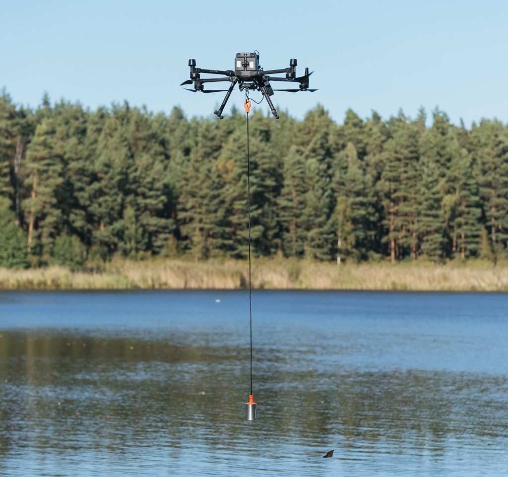
Drone bathymetry using an echosounder is an advanced method for measuring the depth of water bodies and mapping underwater topography. An echosounder emits sound pulses into the water, and by measuring the time it takes for these pulses to bounce back from the seabed or riverbed, it calculates the water depth. When mounted on a […]
Sediment Surveys Using GPR

Ground Penetrating Radar (GPR) is a non-invasive geophysical method that uses radar pulses to image the subsurface. When paired with drone technology, sediment surveys using GPR become more efficient and accurate, providing a 3D mapping of sediment layers, deposits, or subsoil structures. This survey is widely used for applications such as sediment transport studies, erosion […]
Revolutionise Cleaning with Drone Power Washing!

Our drone power washing services utilise cutting-edge technology to provide a faster, more efficient, and environmentally friendly way to clean your property. Our drones are equipped with high-pressure washing systems, cameras, and sensors to ensure precise and effective cleaning. Benefits: Increased efficiency: Clean large areas quickly and effortlessly Improved safety: Reduce risk with minimal human intervention Environmental […]
Search and Rescue Operations

In the world of search and rescue, the integration of drone technology has emerged as a game-changing force, presenting endless advantages that surpass traditional methods. Rapid Deployment and Response: Drones enable swift deployment in emergency situations, providing immediate eyes in the sky. Unlike traditional methods that may involve time-consuming preparations, drones are ready for take-off […]
Electrical Pylon Inspections

The application of drone technology in electrical pylon inspections has emerged as a transformative approach, delivering a range of benefits that surpass traditional methods. Heightened Safety Protocols: Drones play a pivotal role in enhancing safety during electrical pylon inspections. By eliminating the need for personnel to climb pylons or employ complex rigging systems, drones significantly […]
Solar Panel Farm inspections

The integration of drone technology has revolutionised the landscape of solar panel farm inspections, introducing a host of benefits that eclipse traditional methods. Swift and Comprehensive Aerial Inspections: Drones facilitate rapid and comprehensive aerial inspections of solar panel farms. Unlike traditional methods that may involve manual labour and extensive time commitments, drones swiftly navigate over […]
LiDAR Surveys

LiDAR (Light Detection and Ranging) surveys have undergone a transformative evolution with the integration of drone technology, ushering in unparalleled precision and efficiency. Unmatched Data Accuracy and Detail: Drones equipped with LiDAR sensors capture highly accurate and detailed elevation data, surpassing the precision achievable through traditional survey methods. This level of accuracy is critical for […]
Topography

In the field of topographical mapping, drones have emerged as a revolutionary tool, redefining the standards of accuracy and efficiency High-Precision Aerial Surveys: Equipped with advanced sensors and GPS technology, drones conduct high-precision aerial surveys, capturing detailed topographic data with accuracy that surpasses traditional surveying methods. This level of precision is crucial for projects requiring […]