Our drone power washing services utilise cutting-edge technology to provide a faster, more efficient, and environmentally friendly way to clean your property. Our drones are equipped with high-pressure washing systems, cameras, and sensors to ensure precise and effective cleaning.

In recent years, the integration of cutting-edge technology has transformed various industries, and inspections are no exception. The advent of drones has ushered in a new era for surveying roofs and structures, offering a myriad of advantages over traditional methods

As technological advancements continue to reshape industries, the synergy of drones with mapping and thermal surveying has emerged as a transformative force.

In the dynamic landscape of construction, drone technology has emerged as a game-changer in site surveys, presenting a host of benefits that redefine the efficiency and precision of the process.

In the realm of dimensional visualisation and modelling, the integration of drone technology has guided in the transformative era for 3D mapping and modelling.

In the field of topographical mapping, drones have emerged as a revolutionary tool, redefining the standards of accuracy and efficiency

LiDAR (Light Detection and Ranging) surveys have undergone a transformative evolution with the integration of drone technology, ushering in unparalleled precision and efficiency.

The integration of drone technology has revolutionised the landscape of solar panel farm inspections, introducing a host of benefits that eclipse traditional methods.

The application of drone technology in electrical pylon inspections has emerged as a transformative approach, delivering a range of benefits that surpass traditional methods.

In the world of search and rescue, the integration of drone technology has emerged as a game-changing force, presenting endless advantages that surpass traditional methods.

Ground Penetrating Radar (GPR) is a non-invasive geophysical method that uses radar pulses to image the subsurface. When paired with drone technology, sediment surveys using GPR become more efficient and accurate, providing a 3D mapping of sediment layers, deposits, or subsoil structures.
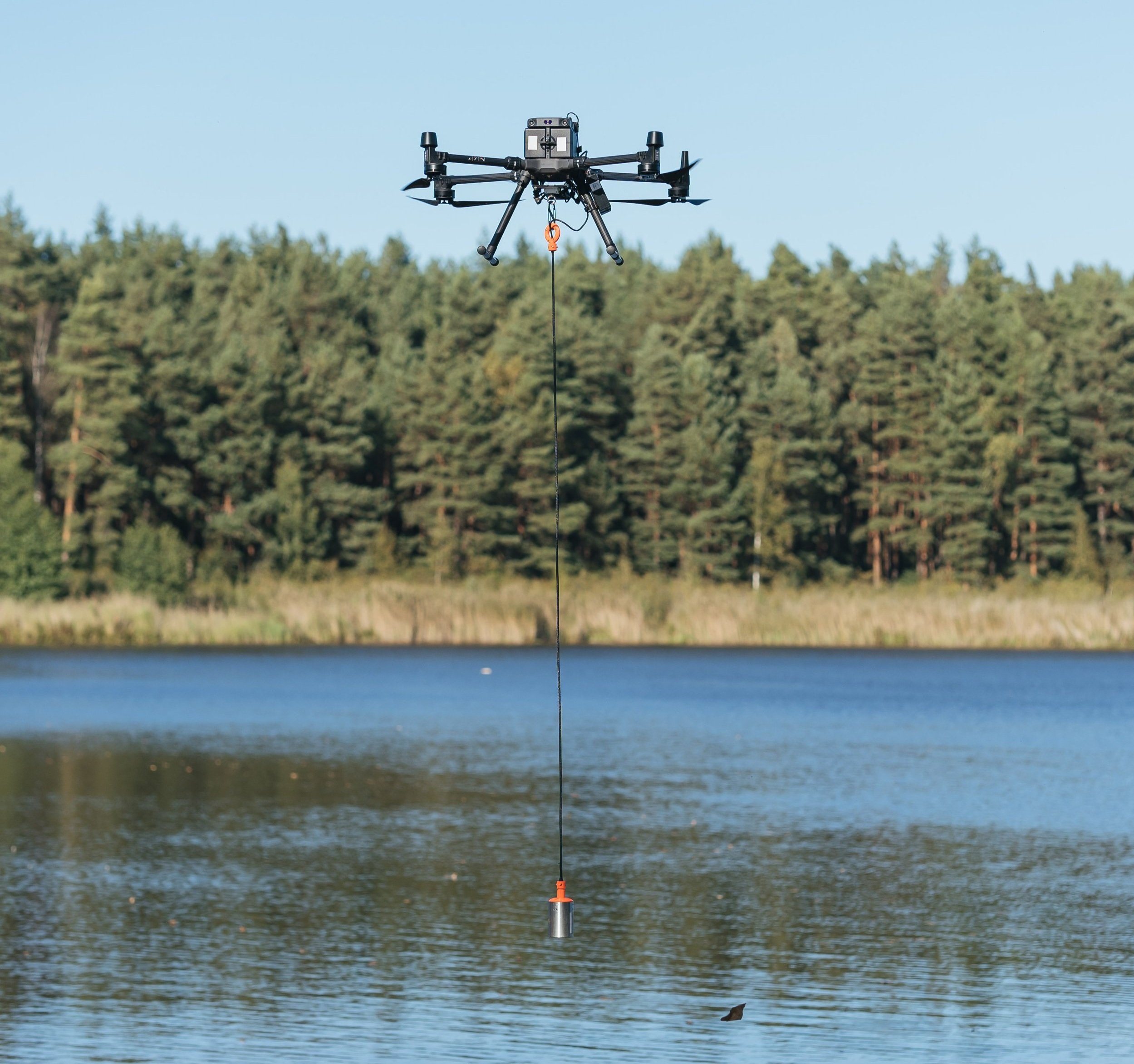
Drone bathymetry using an echosounder is an advanced method for measuring the depth of water bodies and mapping underwater topography. An echosounder emits sound pulses into the water, and by measuring the time it takes for these pulses to bounce back from the seabed or riverbed, it calculates the water depth.

Unexploded Ordnance (UXO) detection is critical for identifying potentially hazardous explosives that remain undetonated in areas affected by military activities.

In archaeology, magnetometers are valuable tools used to detect variations in the Earth’s magnetic field, often caused by buried artefacts, structures, or features such as walls, kilns, or ditches.